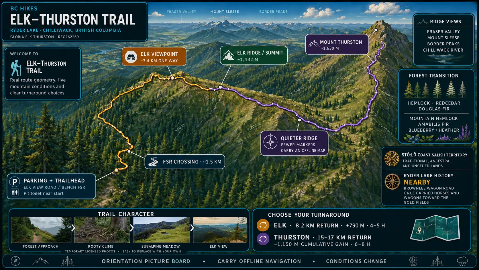
CHOOSE YOUR ROUTE
- Elk return
- 8.2 km
- Elk gain
- 790 m
- Elk time
- 4–5 hours
- Elk high point
- ~1,432 m
- Thurston return
- 15–17 km
- Full day
- 6–8 hours
- Trail type
- Out & back
VERIFIED ROUTE PROFILE
ELK ROUTE
THURSTON EXTENSION
ONE-WAY ORIENTATION PROFILETrailhead → Elk → Mount Thurston
ELK
RETURN8.2 KM
GAIN+790 M
TIME4–5 H
THURSTON
RETURN15–17 KM
CUMULATIVE GAIN~1,150 M
TIME6–8 H
ⓘ ORIENTATION PROFILE · ELEVATION AND DISTANCE VARY BY DEVICE AND TURNAROUND
QUICK ACTIONS
💡 ELK-SPECIFIC TIPS
- Carry all the water you need; dependable water is scarce.
- Use hiking footwear and consider poles for the steep descent.
- Download an offline map before leaving cell service.
- Turn around at Elk unless you have daylight, energy and navigation margin for Thurston.
- Check snow, wildfire, smoke and avalanche information for the season.
〽 SAFETY PULSELoading…
Approved community reports expire after 72 hours.